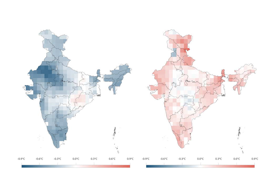
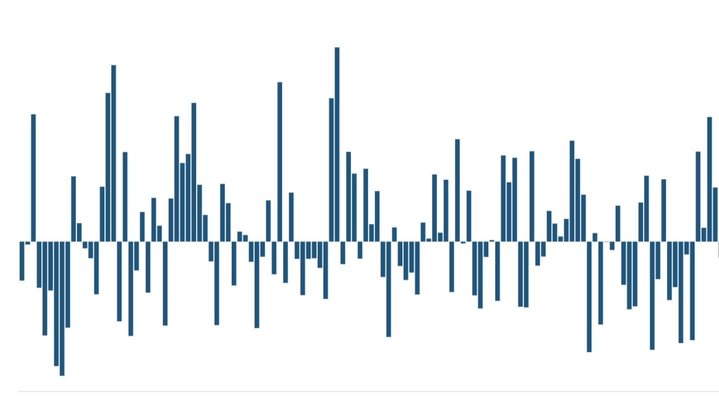
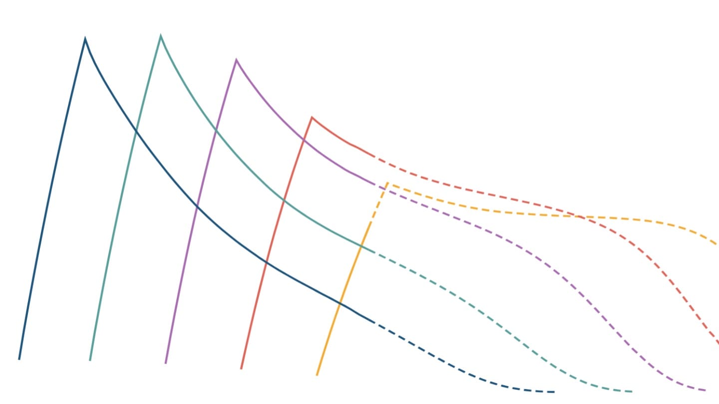
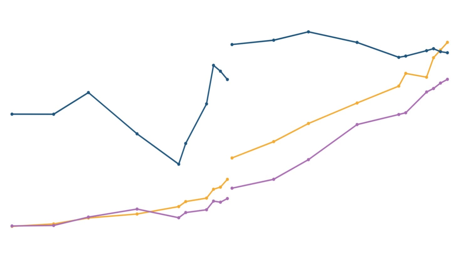
Rainfall trends in India can vary substantially between seasons. In addition to looking at aggregate rainfall during a season, the intensity and frequency of rainfall are two other important indicators that can capture whether rainfall within a season is becoming more or less evenly spread.
A season might record a "normal" total rainfall amount, yet experience severe floods due to a few intense downpours, or face agricultural stress from extended dry spells. It is these intra-seasonal patterns that influence how rainfall is spaced over time and how that directly shapes outcomes for agriculture, water security, and extreme weather events. For example, the same amount of seasonal rainfall can have very different consequences depending on whether it is spread across many rainy days or concentrated in a few intense events. This makes regionally and seasonally resolved analyses essential for understanding how patterns of rainfall are changing in India.
Understanding daily rainfall indicators
Daily rainfall indicators, computed separately for the four meteorological seasons - winter (January-February), pre-monsoon (March-May), monsoon (June-September), and post-monsoon (October-December) - provide a more granular lens through which to examine how India's rainfall regime is evolving. These metrics are constructed using standardised thresholds developed by the Expert Team on Climate Change Detection and Indices,[1] which provide a consistent framework for measuring and comparing climate variability and change by providing international coordination and standardised tools for climate analysis.[2]
Daily rainfall indicators can be broadly grouped into two categories:
- Frequency metrics: which describe how often rainfall occurs and how rainfall and dry periods are distributed within a season.
- Intensity metrics: which measure how heavy rainfall events are and whether rainfall is becoming concentrated in certain places and at certain times.
Together, these indicators provide a more complete picture of how patterns of rainfall are evolving than seasonal totals alone. They also help distinguish between a change in the total amount of rainfall and a change in the way that rainfall is distributed within a season.
When analysing daily rainfall seasonally using gridded data at the national level, the reported values may appear modest because they represent an average depth across the entire country, not the intensity at any specific location. In a large and climatically diverse country like India, rainfall on any given day, even within a single season, is highly localised. Some regions receive heavy downpours, while many others remain dry. Consequently, smaller daily values at the national level occur because rainfall is averaged across regions with differing patterns ranging from heavy rain in some places to little or no rain elsewhere. The indicators therefore describe broader national patterns rather than the rainfall experienced at a particular location.
Pre-monsoon: the season undergoing significant change
While the south-west monsoon contributes most of the annual rainfall in India, changes in rainfall are not seasonally uniform. Among all four seasons, the pre-monsoon season exhibits the clearest and most statistically significant changes across daily rainfall indicators.
Frequency of rainfall
The frequency indicators reveal that rainfall now occurs more regularly during the pre-monsoon season than it did during the first half of the twentieth century (1901-1950). The number of rainy days has increased by nearly 24%, rising at a statistically significant rate of 0.5 additional rainy days per decade.
At the same time, the longest dry spells have shortened by over 14%, declining by approximately one day per decade. Together, these indicators suggest that the pre-monsoon season is experiencing more frequent rainfall and shorter prolonged dry spells. Rainfall is being distributed across more days of the March-May season, while the longest uninterrupted periods without rain are becoming shorter.
Intensity of seasonal rainfall
Pre-monsoon rainfall indicators show sharp increases in both the magnitude and intensity of rain. Total wet-day rainfall has increased by 17% compared with the early twentieth century (1901-1950), the strongest jump among all seasonal indicators, adding nearly 2 mm more rain per decade. Both the highest daily rainfall and the highest five-day rainfall have also risen significantly, at rates of 0.1 mm and 0.3 mm per decade respectively.
Recent years, particularly 2015-2025, have seen increased pre-monsoon activity, with 2025 recording the highest values for both daily and five-day pre-monsoon rainfall. Total seasonal rainfall has also risen sharply from roughly 20-50 mm in earlier decades to 126 mm in 2025, the second-highest pre-monsoon seasonal total over the entire time period. The recent increase is therefore visible both in the long-term trend and in the concentration of some of the highest values in the most recent years.
Altogether, these changes suggest that pre-monsoon rain is occurring on more days, prolonged dry periods are becoming shorter and heavier rainfall events are becoming more pronounced. For agriculture and water management, this means that pre-monsoon rainfall may influence agricultural risk, water availability and preparedness for both heat and rainfall extremes.[3] The pre-monsoon season is also important because it precedes the monsoon season and coincides with some of the hottest months of the year. Changes in rainfall during this period can therefore interact with high temperatures and influence both water availability and exposure to weather extremes.
South-west monsoon: stable rainfall but heavier multi-day events
The south-west monsoon season (June-September), which accounts for the bulk of the annual rainfall in India, shows relative stability in total precipitation and the number of rainy days over the long term.
The south-west monsoon remains the dominant contributor to India's annual rainfall and continues to display remarkable stability across most daily rainfall indicators. Compared with the early twentieth century, both rainfall frequency and seasonal rainfall totals have changed very little.
Frequency of rainfall
The number of rainy days has remained unchanged, declining by only 0.33% (from a mean of 113.3 days) between the early and recent periods. Likewise, changes in wet spells (down just 1%) and dry spells (up by 3%) are small and statistically insignificant, indicating that the overall monsoon has remained largely stable despite considerable annual variability. Neither change is statistically significant, reinforcing the picture of an overall stable monsoon rainfall.
Intensity of rainfall
The intensity indicators reveal a more nuanced pattern. Although the monsoon is not becoming substantially wetter overall, rainfall may be increasingly delivered through more intense multi-day rainfall episodes. Such changes help explain why severe flooding can occur even during years when seasonal rainfall remains close to normal.
While total rainfall received on rainy days has remained almost unchanged and maximum daily rainfall has increased only modestly (1.2%), maximum five-day rainfall has increased significantly, indicating that rainfall is becoming more concentrated within multi-day wet spells.
The key change in the monsoon is not a clear increase in the total amount of rainfall, but a possible shift in how some of that rainfall is delivered. More intense multi-day events can increase the risk of flooding and waterlogging even when rainfall over the entire season remains close to its long-term average.
Winter and post-monsoon: variability continues to dominate
Unlike the pre-monsoon season, neither winter nor post-monsoon exhibits statistically significant long-term changes across the daily rainfall indicators. Rainfall during the post-monsoon and winter seasons is typically low and episodic, often driven by western disturbances in winter and cyclonic systems in the post-monsoon season.
Frequency of rainfall
Winter shows a modest decline in rainfall frequency, compared with the early twentieth century (1901-1950), with 13% fewer rainy days, 11% shorter wet spells, and 5% longer dry spells. These changes are broadly consistent with the gradual weakening of winter rainfall but remain statistically insignificant. The observed changes therefore indicate a possible direction of change rather than a robust long-term trend.
The frequency of post-monsoon rainfall shows considerable year-to-year variation, but does not exhibit a statistically significant long-term change. The recent period (1991-2025) recorded 2% more rainy days than the early twentieth century (1901-1950), while the longest wet spell was 5% shorter and the longest dry spell was 1% longer. This is particularly relevant for southern India, where post-monsoon rainfall contributes substantially to annual rainfall and individual weather systems can produce large differences between years. Changes in the timing and distribution of rainfall can therefore have important implications even when the overall seasonal total does not show a clear long-term trend.
Intensity of rainfall
Winter also exhibits modest reductions in rainfall intensity, with total wet-day rainfall declining by 18%, maximum daily rainfall by 11% and maximum five-day rainfall by 15% relative to the early twentieth century. Post-monsoon rainfall intensity shows modest observed increases between the early period (1901-1950) and the recent period (1991-2025), but there is no statistically significant evidence of a long-term trend. Total rainfall on wet days was 7% higher, while maximum one-day and maximum five-day rainfall were 6% and 8% higher, respectively.
However, none of these changes are statistically significant. The lack of statistical significance means that the observed changes cannot be distinguished confidently from year-to-year variability. They therefore indicate a possible direction of change rather than a robust long-term trend.
Uneven change in rainfall across seasons
Examining rainfall at the daily scale reveals that India's rainfall is not changing uniformly throughout the year. The pre-monsoon season stands out as the period undergoing the most substantial change with more frequent rainfall, shorter dry spells and stronger heavy rainfall events than were observed during the early twentieth century. During the south-west monsoon, seasonal rainfall remains broadly stable, but multi-day heavy rainfall events are becoming more intense. Meanwhile, the winter and post‑monsoon seasons remain largely unchanged, with no robust directional trends. Taken together, these findings suggest that the changes in rainfall pertain less to how much rain the country receives each year and more to when, how frequently and how intensely that rain falls.
[1] The Expert Team on Climate Change Detection and Indices (ETCCDI) is a joint international initiative sponsored by the World Meteorological Organization (WMO) and other partner bodies. It has defined a core set of 27 standardised indices for temperature and precipitation extremes, including metrics such as consecutive dry days and maximum five-day rainfall, that have become the global standard for monitoring changes in climate extremes and are widely used in IPCC assessments.
[2] Indices and Data (n.d.), Expert Team on Climate Change Detection and Indices (ETCCDI), World Climate Research Programme / CLIVAR.
[3] Changing dynamics of pre-monsoon rainfall over India (1963-2022): The role of ocean-atmosphere drivers and regional impacts (2026), Satyanarayana et al., Atmospheric Research.